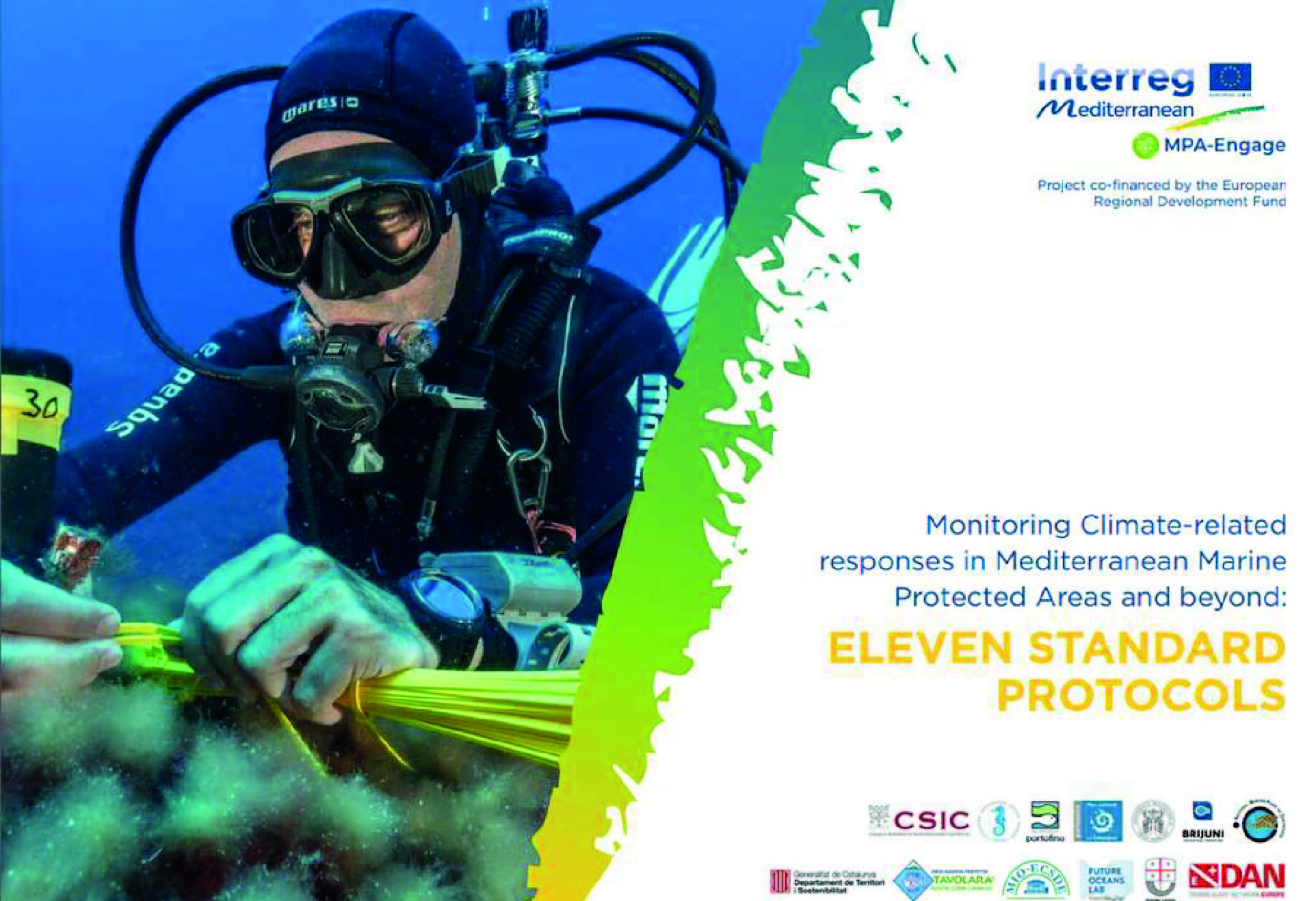
 MONITORING TOOL
Monitoring Climate Change Impacts in Mediterranean MPAs
TO WHOM IS ADDRESSED?
Hydrographic offices, Marine Protected Area (MPA) managers, marine scientists, national oceanographic agencies, policy-makers, the interested general publicTHEME
Climate changeKEYWORDS
Alien species, citizen science, climate change, mass mortality, MPA, Photogrammetry, Pinna nobilis, Posidonia oceanica, protocol, sea urchins, seawater temperature

WHAT PROBLEM WOULD THIS SOLVE?
The effects of climate change are particularly alarming for the Mediterranean Sea, which is warming faster than the global oceans. Documenting these changes is a key task to support Integrated Coastal Zone Management (ICZM) and to inform maritime spatial planning (MSP). Nevertheless, the complexity of ecological transformation, along with inadequate human and financial resources, typically hamper our observation capabilities. Mediterranean MPAs can play a primary role in providing a systematic and harmonised observation system, translating principles already consolidated in the political framework, to the real world.
Aim of the tool
The aim of these standard monitoring protocols, developed by the projects MPA-Adapt and MPA-Engage, is to help track climate-related impacts in Mediterranean MPAs and beyond, following the requirements of the Ecosystem Approach and within the framework of the UNEP/MAP Barcelona Convention.
Main objectives
The objective of these standard protocols is to capture greater dimensions of environmental change through a restricted set of simple measurements related to temperature, mass mortality, species abundances and distribution, and historical changes, including climate-sensitive species of both native and alien origin.

WHAT IS NEEDED FOR IMPLEMENTATION?
Technological infrastructure
Specific technological requirements are in place for the following protocols:
- Monitoring temperature conditions: Temperature data loggers HOBOTidbit v2 or HOBO-U22 and related software;
- Mass mortality events: Diving computer to set the depth of the survey;
- LEK-1, LEK-2, and LEK-3: An excel file for data collection;
- Fish visual census: Diving computer to set the survey depth, measure transects time (5 minutes) and water temperature;
- Posidonia oceanica (POFA): A deep gauge or diving computer to record the depth of the survey; a GPS (on board);
- Pinna nobilis (FAP): Underwater compass; GPS; Underwater camera with housing and electronic strobes or focus providing continuous lighting;
- Benthic alien species (BARD): A portable GPS (on board); underwater camera with housing and external light system (e.g., electronic strobes); photoQUAD software for image analysis; and
- SFM photogrammetry: Underwater camera and housing; ground control points (GCPs) for geo-reference processing.
Training
Video tutorials are available in the T-MEDNet Platform on how to monitor temperature, deploy temperature data loggers for monitoring seawater temperature and monitor and conduct surveys on mortality. A video tutorial for fish visual census is also available in the ISPRA and MPA-Adapt YouTube channel. In addition, video tutorials have been developed for LEK-1, LEK-2, and LEK-3 and for monitoring rocky habitats (including fish, sea urchins, and alien species).
Temperature monitoring and benthic assessments of alien species (Benthic Species Rapid Detection-BARD) should be conducted by certified scuba divers, working in pairs. The mass mortality assessment, the fish census and the assessment of Posidonia oceanica (POFA) can also be performed by recreational divers once adequate training is received. MPA staff training is needed to monitor Pinna nobilis (FAP) and to implement fieldwork for the SFM photogrammetry protocol. For LEK-1, LEK-2, and LEK-3, interviewers should be practitioners skilled in species identification with good knowledge of local fisheries and/or underwater environments.
Investment
The estimated cost to implement the temperature monitoring protocol is 1,800 € per MPA.

HOW TO USE IT?
Concept
These protocols are inspired by the concept of Essential Climate Variables, and focus on a restricted set of simple measurements to capture greater dimensions of environmental change. The indicators have been chosen on the basis of their scientific relevance, feasibility and cost effectiveness. The first five protocols have been developed by the project MPA-Adapt; these were later complemented by six other protocols, developed by the project MPA-Engage. They cover:
- Temperature conditions – to build robust baselines and track hydrological changes to better understand the impacts climate warming has on marine coastal biodiversity.
- Impact of mass mortality on macro-benthic species dwelling in coastal waters.
- Local Ecological Knowledge to reconstruct historical changes – to interview experienced fishermen or other sea users, to gather information on historical changes in species abundances and distribution (LEK-1), regularly monitor climate-sensitive species of both native and exotic origin (LEK-2), and to assess mass mortalities in marine organisms (LEK-3).
- Fish visual census – to assess the abundance and distribution of specific fish species as reliable indicators of climate change.
- POFA – to measure the density of leaf shoots of Posidonia oceanica and additional characteristics linked to warming.
- FAP – Pinna nobilis populations within MPAs.
- URCH – Sea-urchin populations in shallow rocky habitats within MPAs.
- BARD – Benthic invasive species in rocky benthic habitats within MPAs.
- SFM Photogrammetry – to characterise habitat complexity and distribution patterns of populations of key species and track their changes over time through 3D habitat mapping.
Pilot areas
These protocols have been piloted in more than 70 sites across Spain, France, Italy, Croatia, Greece, Turkey and Tunisia.
Implementation Dates
- Temperature conditions: It is recommended to set up and retrieve data loggers every 6 months, generally before and after the warm season. A yearly periodicity can be adopted for remote sites.
- Mass mortality: It is recommended to monitor mass mortality every 12 months after summer, i.e. from mid-September to mid-October, or in cases of observed mass mortality events.
- LEK-1 and LEK-3: Interviews can be performed at any time of the year.
- LEK-2: Interviews should be performed every 12 months; the respondents should ideally remain the same across time.
- Fish visual census: It is recommended to perform the fish census every 12 months, between August and October; for recreational divers, the census can be performed at any time of the year.
- POFA: The period for monitoring should be during summer and autumn on an annual basis. However, from the end of September-October, flowering events might be more likely, this period is recommended for surveys. Also, the presence of fruits on the plant is an indicator and allows monitoring during spring (April-May).
- FAP: The period of monitoring should be late summer/ autumn.
- URCH: Sampling should be performed once per year in the late summer, when seasonal algae have disappeared.
- BARD: Sampling should be carried out twice a year in summer and winter. If this is not possible due to logistical or financial constraints, monitoring should be run at least once a year, preferably in summer, and at the same time each year.
- PFM: The monitoring period must be adapted to each MPA depending on which period it has better water transparency conditions, which is usually during summer or early fall.

WHAT CHALLENGES MAY ARISE?
To ensure the continuity of temperature data series, temperature data loggers should be launched with the correct parameters prior to being placed again in the field, and should be solidly attached to the substrate to avoid losing them due to rough sea conditions.
Looking for small gorgonians’ colonies or specimens (less than 15 cm in height) may not be straightforward during the sampling. It is recommended therefore, to exclude them from sampling.
Fishermen may distrust researchers and practitioners. As such, special attention should be given to the approach used during the interviews, e.g. by showing genuine interest towards the answers and by behaving like a facilitator and not an expert.

WHAT ARE THE EXPECTED RESULTS?
Quantitative results
The implementation of the proposed protocols allows the collection of important physical and biological data that is necessary to understand climate change and seawater warming in the Mediterranean. Such data also supports the drafting and implementation of adequate mitigation strategies and effective adaptation plans in Mediterranean MPAs.
Key deliverables
Comprehensive sets of monitoring data describing specific biological and physical features of the marine environment that will help assess the impact of climate change in Mediterranean MPAs.
Transfer potential
The protocols can be shared, downloaded and printed by Mediterranean MPAs and can be used in non-commercial products or services, provided that appropriate acknowledgment of the MPA-Adapt and MPA-ENGAGE projects as the source and copyright holder is given.
Pilot areas
This tool has been implemented in more than 70 sites.
KEY INFORMATION
Pinna nobilis clams lost
Monitoring sites
Trials
- The Mediterranean Sea is warming three times faster than the global average, with the past seven years set to be the warmest on record. This results, inter alia, in increasing frequency of “Medicanes”, native fish species’ northward migrations, alien species invasion and mass mortality events (80-100% Pinna nobilis lost in the last years).
- The first five protocols have been developed by the project MPA-Adapt. The project MPA-Engage capitalised on the experience gained through this project, and developed six other protocols, which further expanded the range of action to tackle climate change in Mediterranean MPAs.
- Climate Change protocols have been implemented 55 times overall across the seven MPAs, for a total of 167 monitoring sites and 868 trials. In all MPAs, data were gathered at three different depths (shallow, intermediate and deep) and involved citizen scientists 533 times.
For further information
Project contact:
Project led by the Institut de Ciències del Mar (ICM) of the Spanish National Research Council (CSIC) http://www.icm.csic.es/en
Lead researcher: Joaquim Garrabou
Links of interest
- T-MEDNet Platform
- Monitoring Climate-related responses in Mediterranean Marine Protected Areas and beyond: FIVE STANDARD Protocols
- MPA ENGAGE 11 Standard Protocols
- T-MEDNet Video Tutorials
- MPA ENGAGE Toolbox
Partners
- Agence Française pour la Biodiversité (AMP)
- Arco Latino – BLUETOURMED Horizontal Project
- Association for Protection of Aquatic Wildlife of Albania
Balearic Islands Regional Government - Bonifacio MPA – Office Environemental de Corse – Parc Marin
- International des Bouches de Bonifacio
- CNR/IRBIM – Istituto per le Risorse Biologiche e le Biotecnologie Marine
- CONISMA-Consorzio Nazionale Interuniversitario pel le scienze del Mare
- CPMR-Conference of Peripheral Maritime Regions of Europe
- CSIC – Institute of Marine Sciences
- Calanques National Park
- Canarias Regional Government
- Cerbère-Banyuls MPA / Conseil Départemental 66
- City of San Benedetto del Tronto
- Consortium of Management of Portofino MPA
- Corsican Agency for Environment (OEC)
- Cote Agathoise MPA / Agde Municipality
- DAN Europe Foundation
- ENSSMAL Algeria – Ecole Nationale Supérieure des Science de la Mer et de l’Aménagement du Littoral
- Enalia Physis Environmental Research Centre
- European Topic Centre – University of Malaga
- FAO – Food and Agriculture Organization of the United Nations
- Fundación Biodiversidad España (AMP)
- Girona University
- INAT (Tunisia) – Institut National Agronomique de Tunisie
- International Union for Conservation of Nature (IUCN) – Centre for Mediterranean Cooperation
- Island of Ustica MPA
- Isola dell’Asinara MPA
- Italian National Institute for Environmental Protection and Research (ISPRA)
- LIFE – Low Impact Fishers of Europe Platform
- MPA Adapt
- MPA Arcipelago Toscano – Parco Nazionale Arcipelago Toscan
- MPA Engage
- Management Agency of Zakynthos National Marine Park (NMPZ)
- Management consortium of Marine Protected Area of Tavolara Punta Coda Cavallo
- Marine protected Area Pelagie Islands – Management Body
- Municipality of Lampedusa and Linosa
- Mediterranean Information Office for Environment, Culture and Sustainable Development (MIO-ECSDE)
- Mediterranean Institute of Oceanography
- Mediterranean Protected Areas Network – MedPAN
- Ministry of Territory and Sustainability, Government of Catalonia
PADI EMEA Limited - Polytechnic University of Marche
- Port-Cros National Park
- Public Institution Brijuni National Park
- Regional Activity Centre for Specially Protected Areas – RAC/SPA
- Regional Natural Park of Corsica
- Regione Liguria
- Spanish Ministry of Agriculture and Fisheries, Food and Environment
- Spanish National Research Council (CSIC)
- Stazione Zoologica Anton Dohrn
- Sud PACA Regional Government
- Torre del Cerrano MPA
- Universitat Autonoma of Barcelona
- University of Malta
- University of Vigo –Future Oceans Lab
- Université de Rabat-Mohamed V
- WWF Mediterranean
Project


