

Data knowledge
This section describes and provides access to the overall geospatial information used by the MBPC community. The spatial data are organized by INSPIRE compliant metadata within a Geospatial metadata catalogue , which facilitate the discovering and download.
Additionally, per each data and metadata is provided access through OCG compliant services helping the users in visualizing in a combined way, into the MBPKP spatial viewer or as independent services in other interoperable platforms. Below can be consulted some existing interactive thematic viewers
Access the map viewer
Don't know where to start?Check the map viewer tutorial
Data catalogue
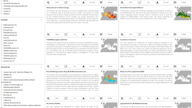
The MBPKP catalogue is public available and supports user in discovering data of high relevance for the MBPC community, including data produced by the modular projects, external projects, and additional European, National, or local initiatives. The data can be searched by using a free text search engine and predefined filters available on the left-side panel fed by the metadata details.Access the data catalogue
Metadata
The MBPKP catalogue provides harmonized metadata under a defined template (Panacea/MBPC) in compliance with ISO 19115:2003 and ISO/TS 19139:2007 standards and INSPIRE Implementing Rules and Technical Guidelines. The metadata describe the data providing a set of thematical and technical information, and indicating clearing the legal constraints and ownership to guarantees.MBPKP metadata guidelines
Thematic viewers
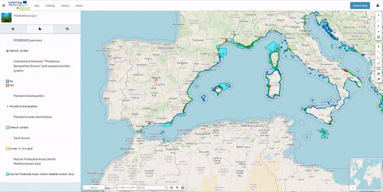
The combination of the spatial data are used to combine simple interactive maps, to represent the distribution of the MBPC partnership or specific thematic topics, e.g POSBEMED. The spatial viewer allows to zoom in/out on the data, query the information of the attribute table, retrieves Metadata information, and it links directly to the MBPKP catalogue trough the “Catalogue” entry on the main bar. This access facilitates the inclusion of additional data available in the platform. Here are two examples of what can be built with our map tool.
Seagrass to prevent degradation
The map highlights the results of the POSBEMED project the presence of Posidonia oceanica banquettes along the Mediterranean coast and the locations in need of a sustainable management of these particular dune systems in the region.Access the viewer

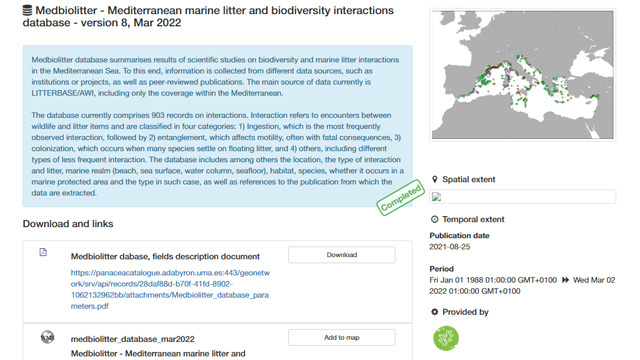
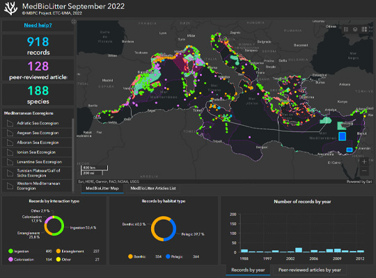
MedBioLitter: Living with marine trash
This map provides access to latest publications and evidence on the different kinds of impacts that litter can have over key Mediterranean species in different contexts, from floating to the sea floor, and the areas in need for further research.Access the viewer
More about MedBioLitter
Do you want to know more?
Interactive data tool
Explore spatial data on relevant topics and quickly extract statistics with an user friendly interface.
More about it!
Library of resources
Documents and multimedia resources associated to projects and keywords.
More about it!